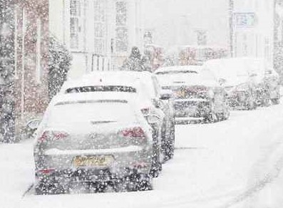
Snow and ice blanketing the UK could last into the weekend and beyond as the Met Office extends weather warnings.
The most severe conditions will be seen in Scotland, where amber snow warnings came into effect from midday yesterday (Friday). Yellow snow and ice warnings are in place elsewhere until Monday.
Up to 40cm (15in) of snow was set to hit parts of Scotland on Friday, while the Met Office predicted as much as 5cm (2in) in areas across England and Wales. Delays and cancellations to rail and air travel, disruption on the roads and power cuts are all expected as a result of the wintry conditions, the weather service added.
Yellow warnings for snow and ice came into force for large parts of England, Northern Ireland, Wales and Scotland at midnight on Thursday. Different parts of the UK will be impacted at various times across the weekend, with a full list of affected areas, external available from the forecaster.
Most of the warnings were initially set to end today but the Met Office has issued a fresh wave of alerts, with the last ending on Monday. The amber warnings in Scotland are currently due to be in effect.
Areas which will likely be affected by "blizzard conditions" include, Angus, Perth and Kinross, Grampian, Aberdeenshire, Moray and parts of the Highlands. These areas could see power cuts and vehicles risk being stranded, the Met Office warned. With names like Sir Andy Flurry, Robert Brrrns, and Plougher O'Scotland, the Scottish gritter and snowplough fleet is out in force, across the nation's road network.
Meanwhile, multiple crashes were reported in Derbyshire, Lincolnshire and Nottinghamshire, National Highways said, as motorists are urged to seek alternative routes were possible. People are being urged to plan routes carefully and to pack essentials in your car in the event of delays.
Key items to bring include warm clothing, water, a blanket and ice-scraper.


